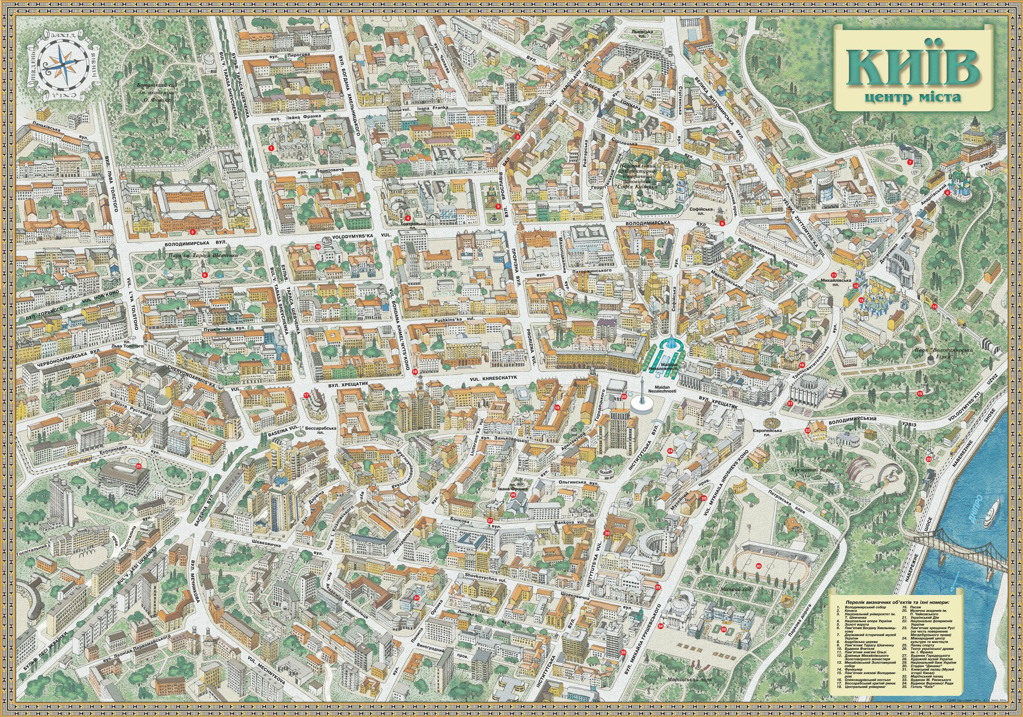
Historical Kiev map
from the year 1700 till nowadays.
Map of Kiev during kn.Olgi (in X century)

Kiev map ears 988 - 1240
This plan represents the schematic view of ancient Kiev and its surroundings, from the time when Prince Vladimir baptized Kiev till the city was destroyed by Batu Khan. The plan represents old place-names and topography, which became known through a famous ancient chronicle «A Tale of the Bygone Years».

З Навчального атласу по російській історії 1887 г.
Масштаб в английскому дюймі 200 саженів.
It is to remember that these plans are not the precise maps. They are some kind of reconstructions made by N. Zakrevskiy – famous chronographer who dedicated his life to the study of Kiev’s history. They reflect his understanding of the location of different places.
Kiev map from 1400 to 1600

Из Учебного атласа по русской истории 1887 г.
Масштаб в английском дюйме 200 саженей.
Plan Ушакова 1695
Древнейший из достоверных, доныне известных планов Киева - план подполковника Ушакова.

Этот план скопирован в 1884 году Киевской Археографической Комиссии, предполагавшей тогда издание серии сохранившихся планов Киева XVIII века
Очень подробный и часто используется в работах по истории Киева
Kiev map (plan) from 1700 to 1800
 from 1700 to 1800")
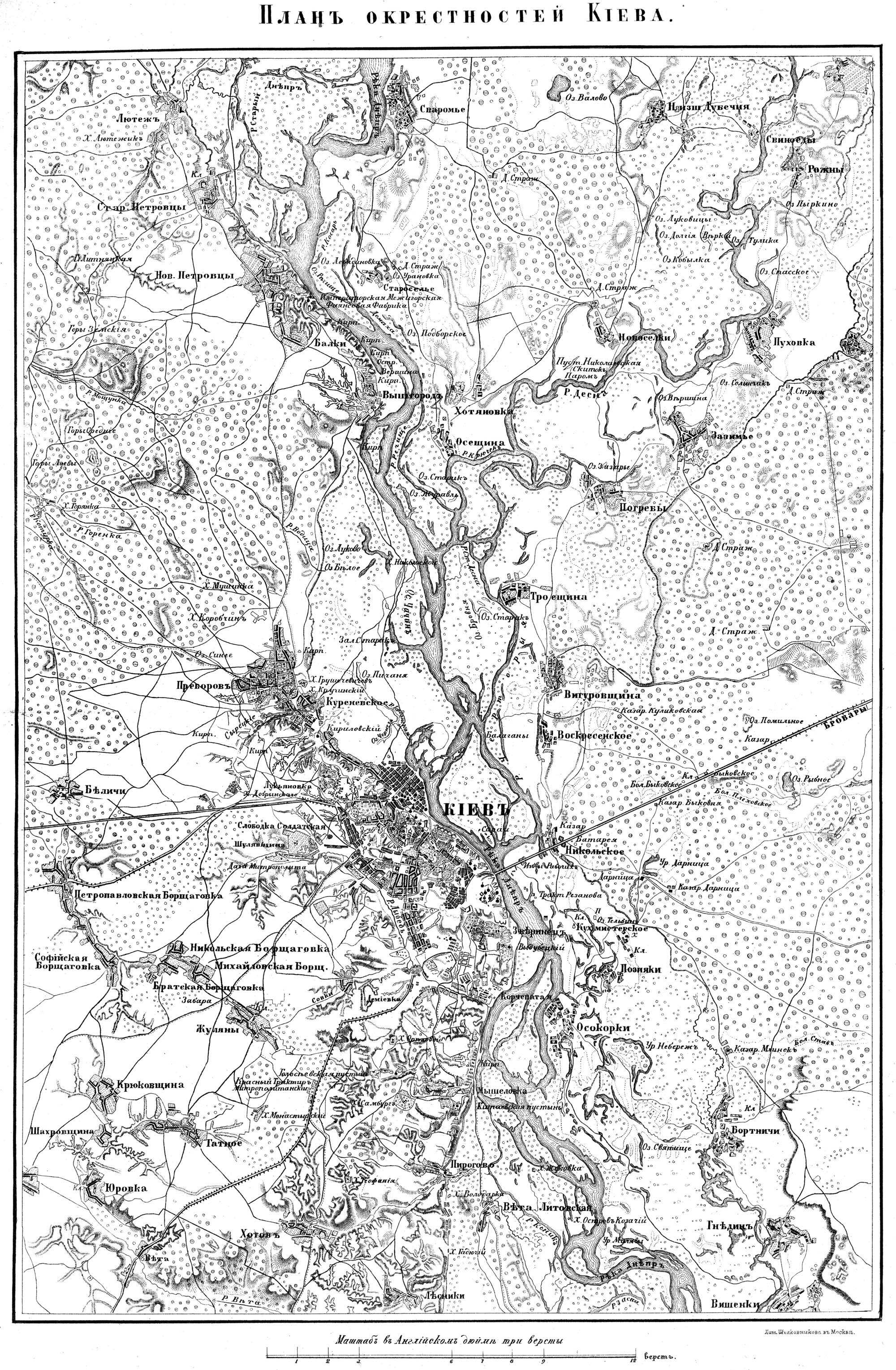
Kiev map 1850
Kiev map 1902

Kiev map 1905

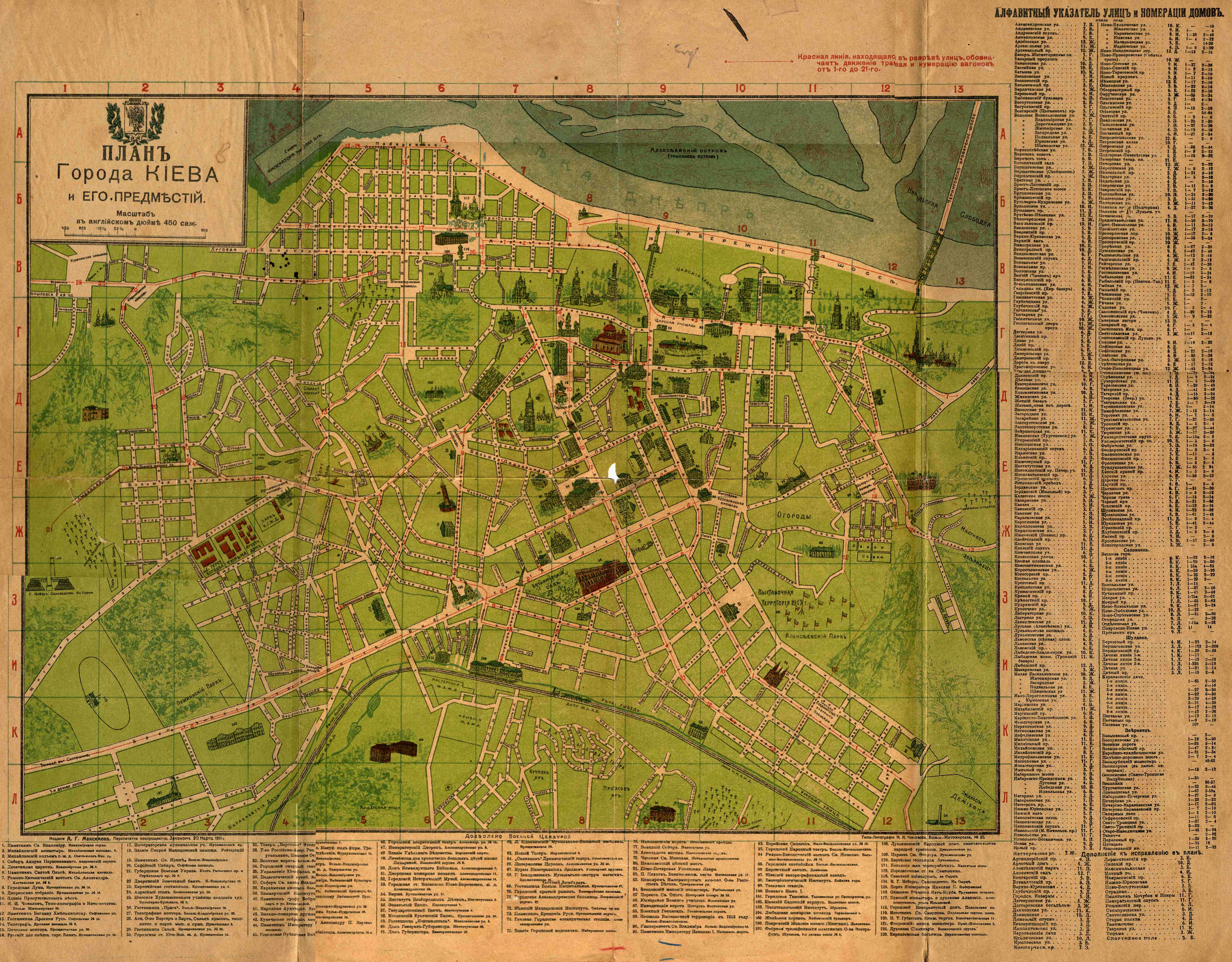
Kiev map 1911
Kiev map 1912
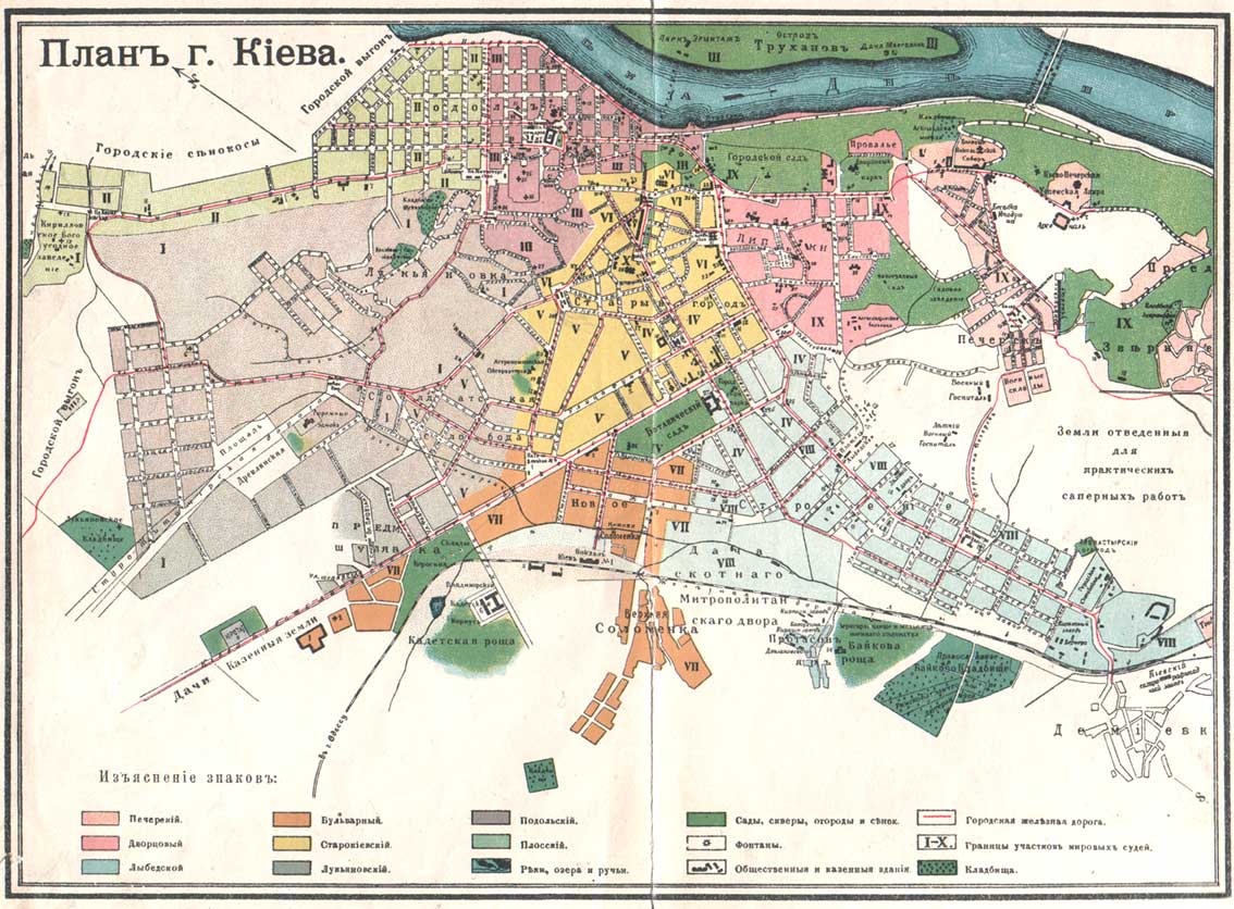
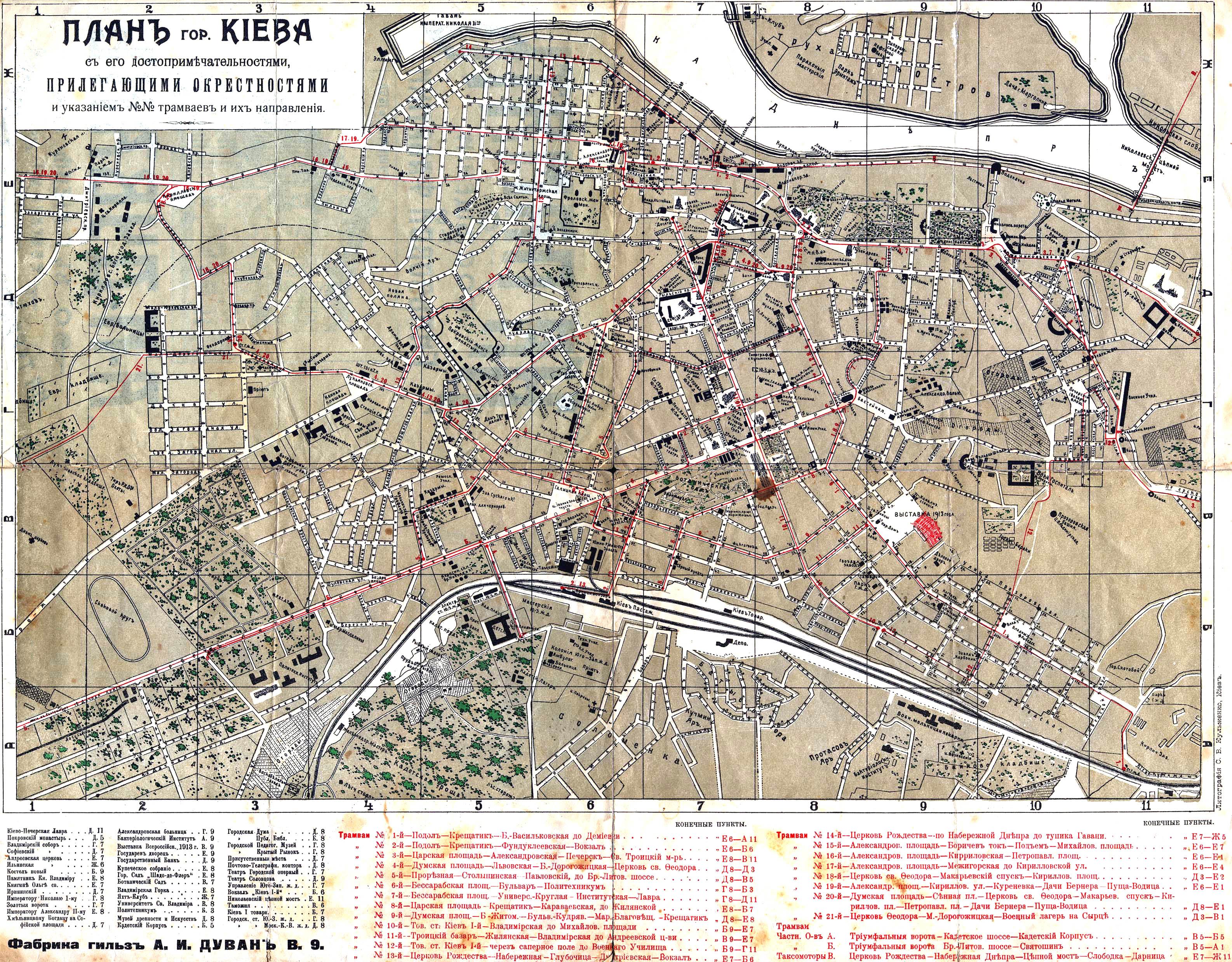
Kiev map 1913
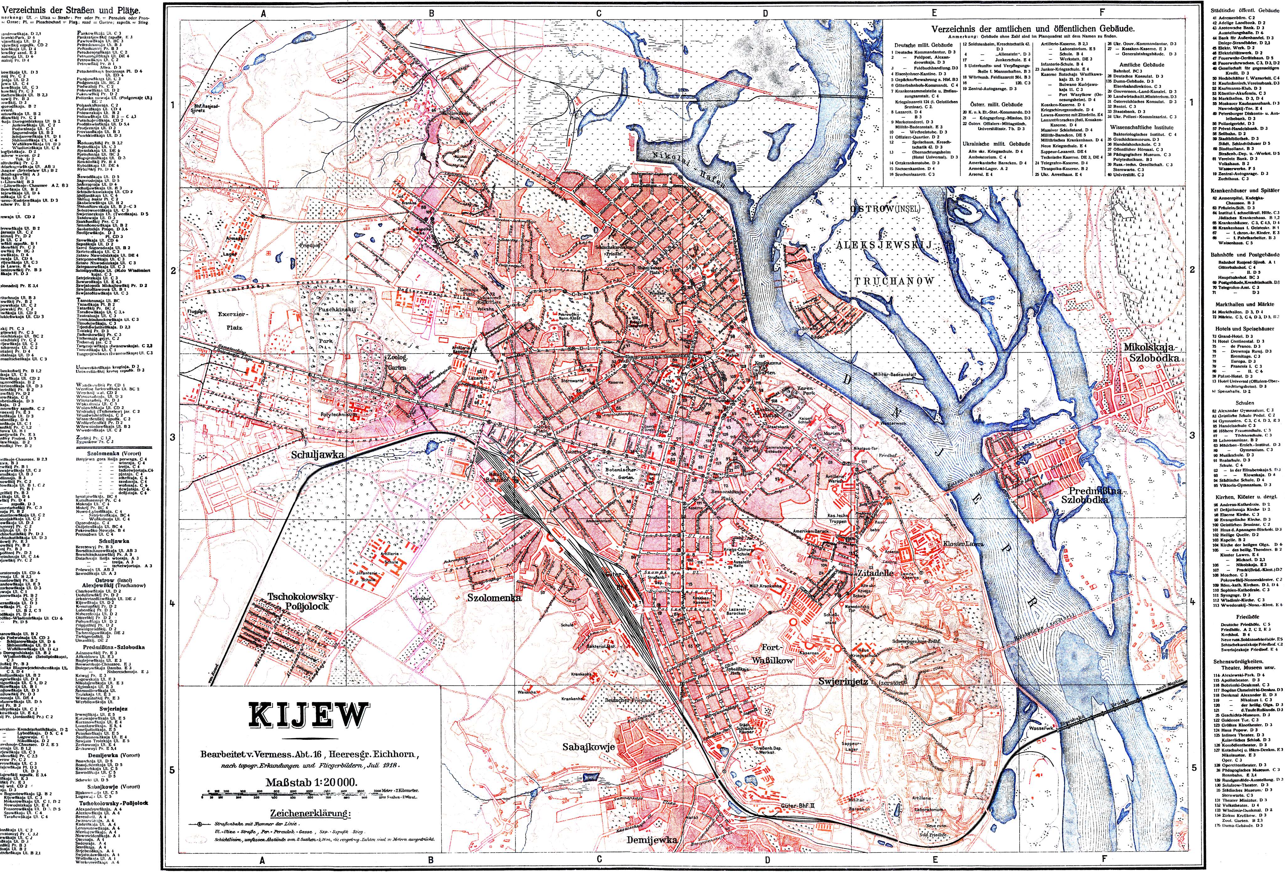
Kiev map 1918
1:20000
Kiev map 1929
1:40000

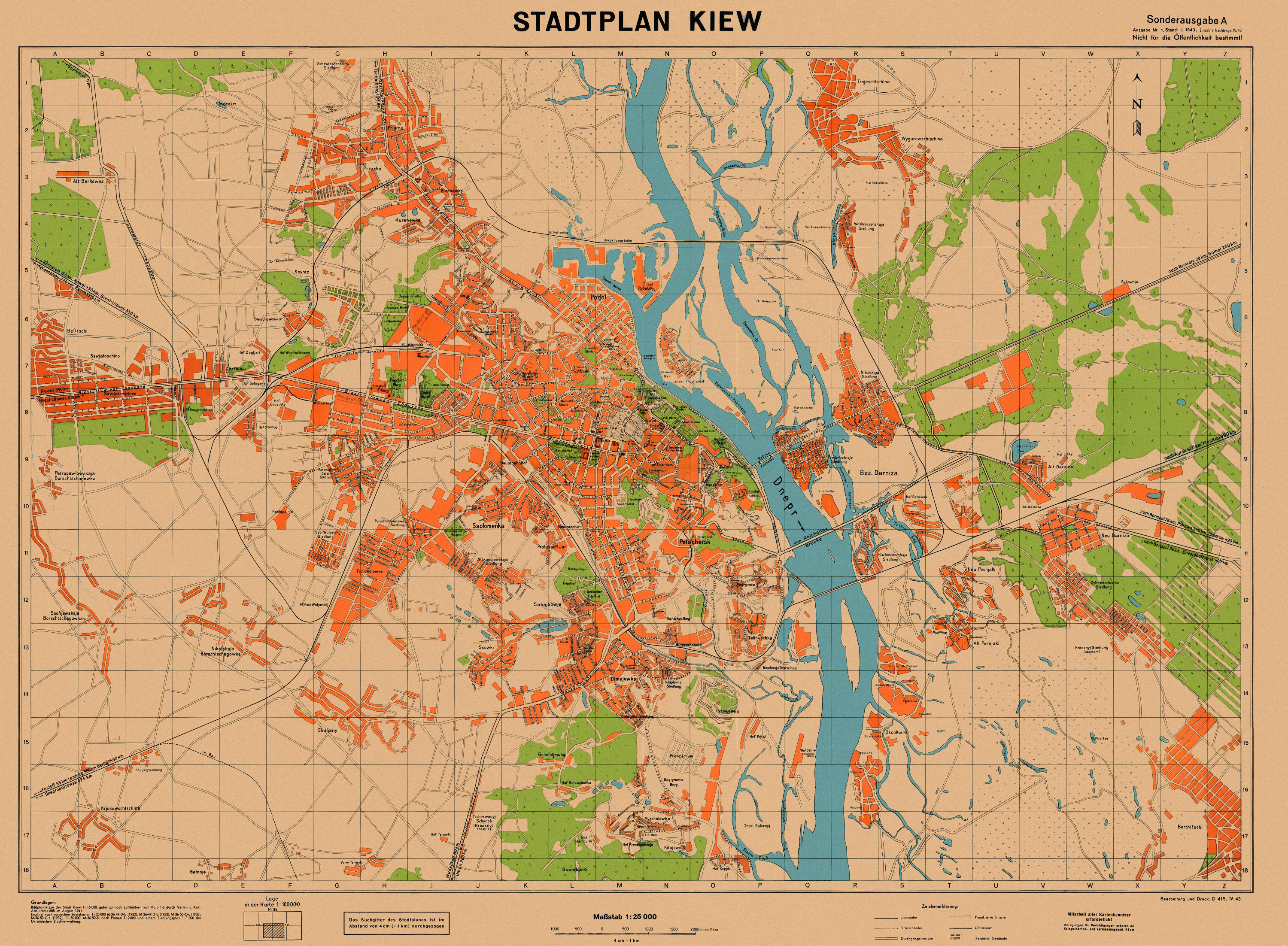
Kiev map 1941
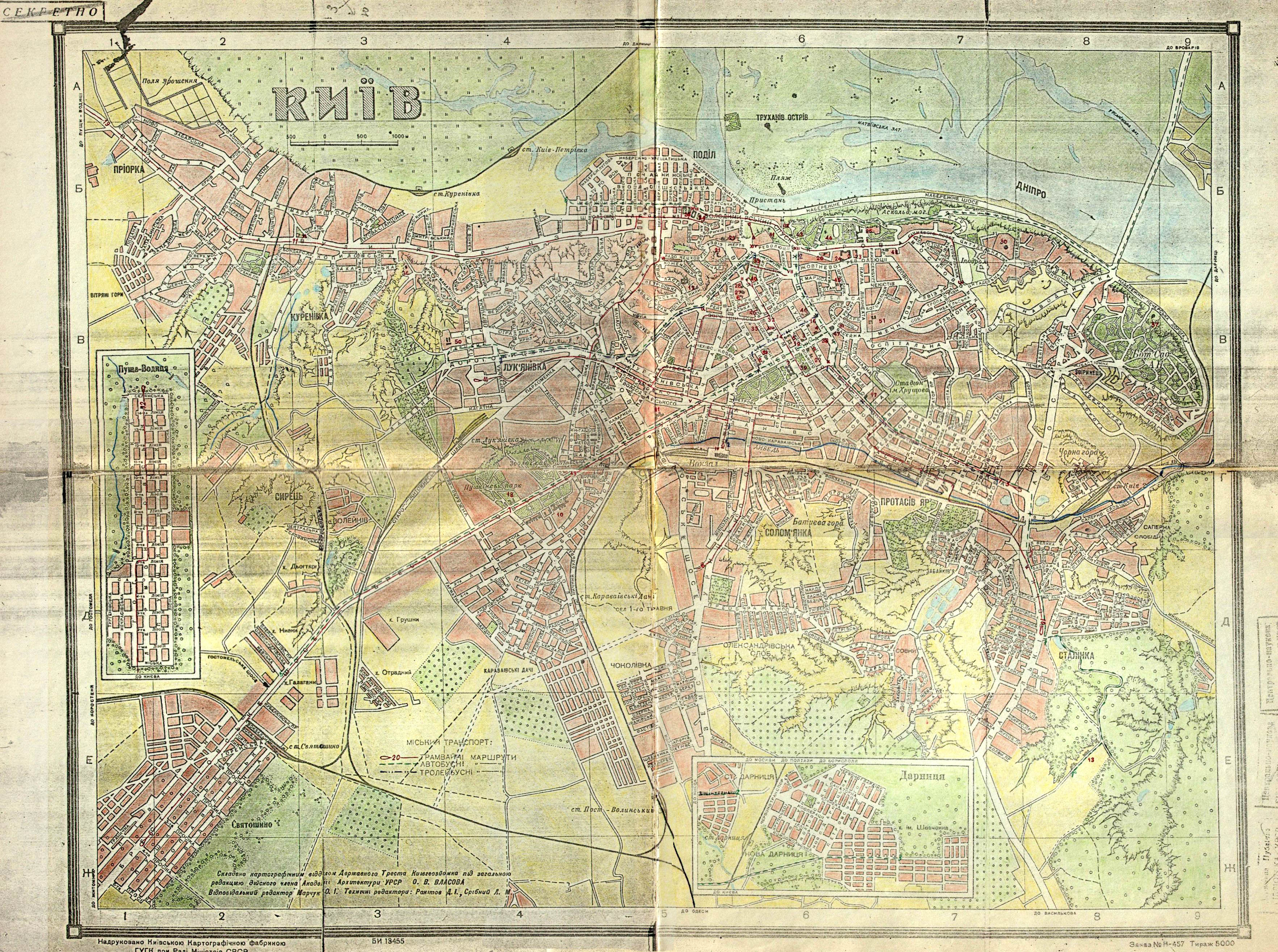
Kiev map 1947
Kiev map